
CHANIA
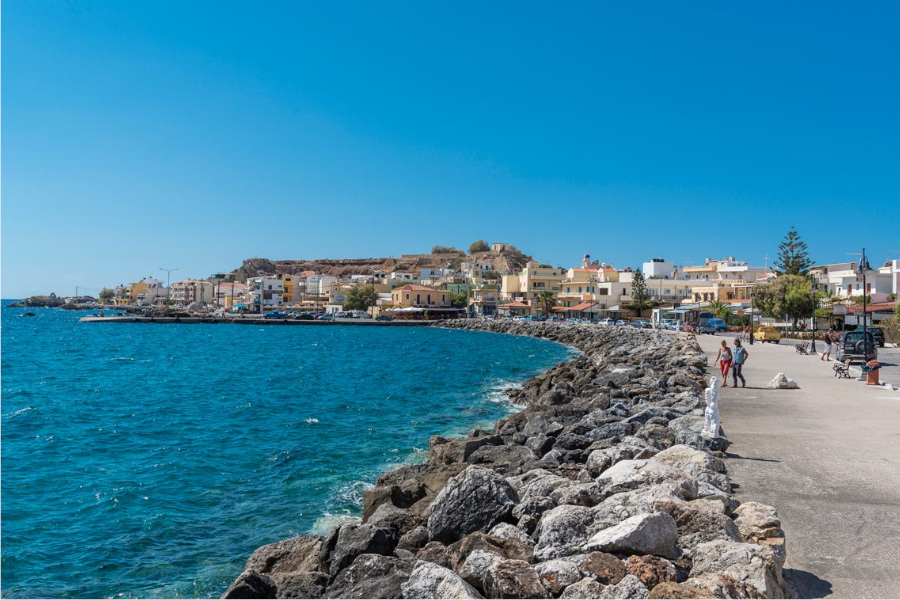
Kisamos
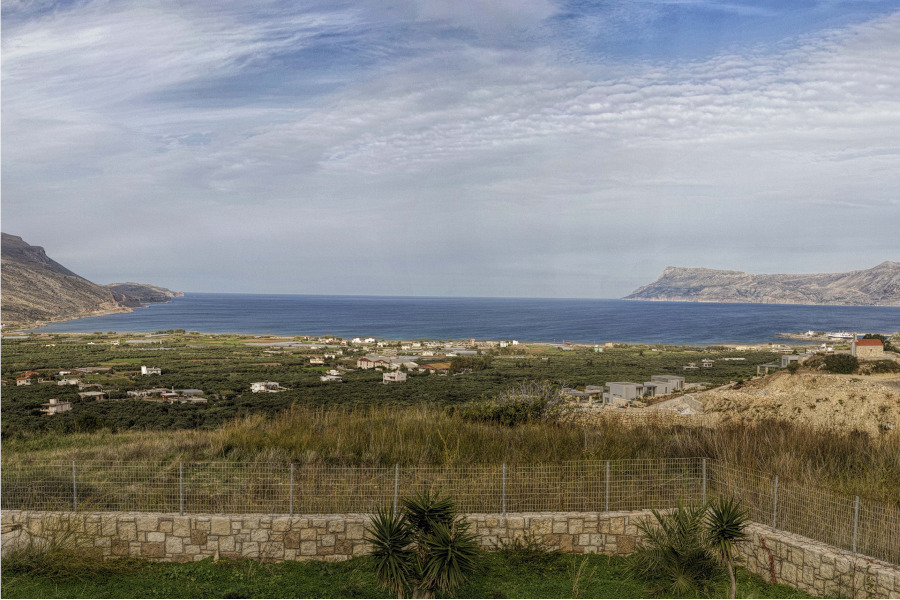
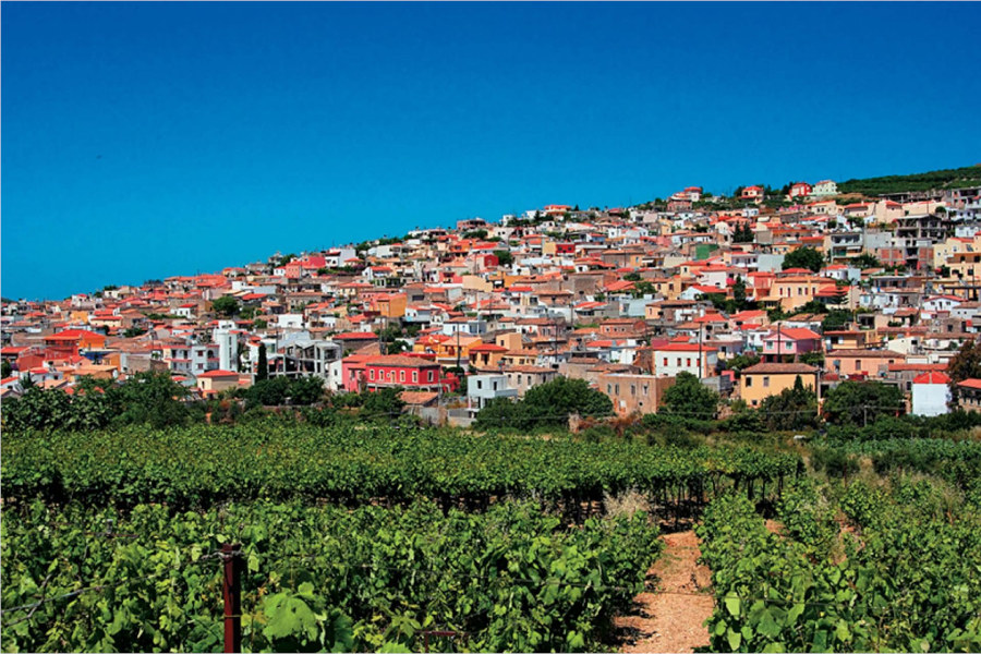
Kissamo is a city located 36 km west of Chania and has about 5000 inhabitants. The correct name is “Kissamos” with an “s”, the name Kissamos is “antidaneio” from the English Kissamos where the 2 “s” were used to correctly render “σ” and not sound like “g”.
The economic development of the region is based more on the wine it produces, the famous Kissamos wine, on the oil and on the production of agricultural products. So the small town has not been turned into a busy tourist resort. The city of Castelli is located at the site of the ancient city of Kissamos.
Often buses connect Kissamos with Chania and, from the port of the city, regular ships leave for Gythio in the Peloponnese, and for the island of Kythira. From Kastelli Kissamos you can visit the interesting archeological sites of Polyrinia and Falassarna, the impressive gorge in Topolia, the islands of Gramvousa and the Lagoon of Balos.
Omalos Plateau
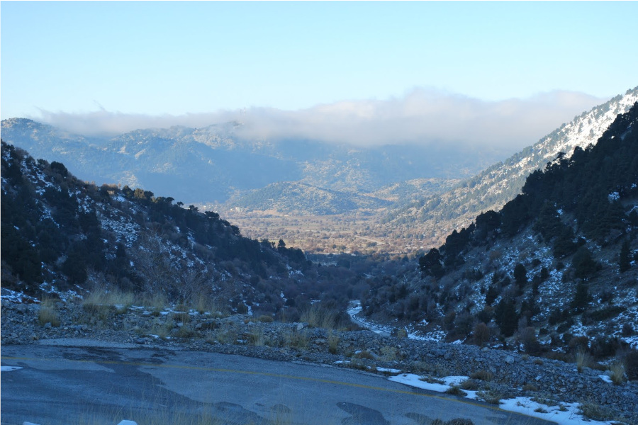
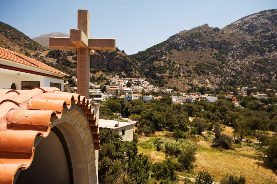
Omalos situated 38 km south of Chania in the White Mountains (Lefka Ori).
During the uprisings against the Ottoman Empire. the Turks rarely managed to penetrate the plateau. The name Omalos is said to have derived from a revolutionary song “Πότε θα κάνει ξαστεριά πότε θα Φλεβαρίσει να πάρω το τουφέκι μου…να κατεβώ στον Ομαλό”.
Only twice did the Turks manage to get there and they endured, to stay, only a few days, during the failed revolution 1886-1888.
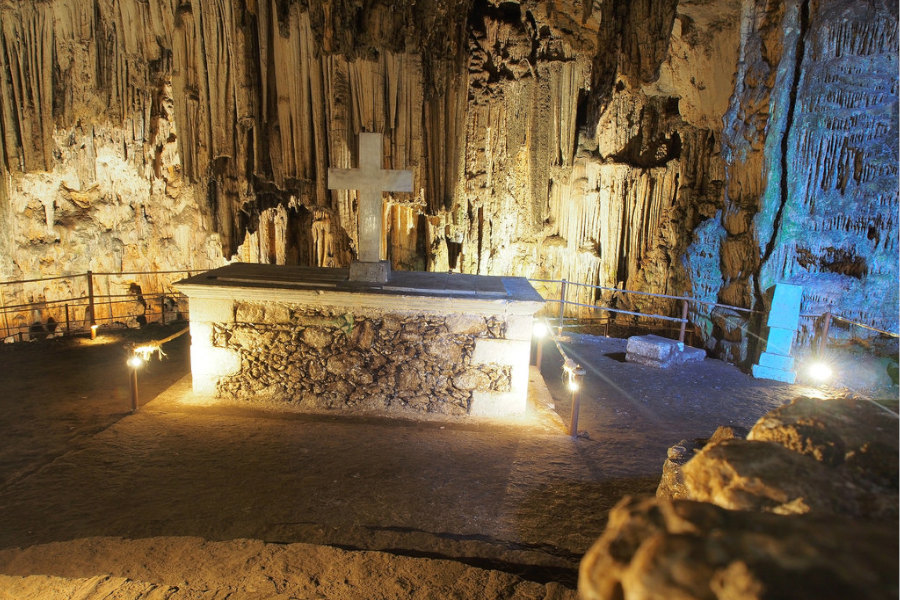
The Tzani cave is named after Tzanis Markos a revolutionary chieftain in the early years of the Turkish invasion who made it his lair.
He was nicknamed “Fobos” (fear). The cave is about 2.5 km long, and descends 241 metres. It is actually a covered gorge.
The Cretan revolutionary Hatzimichalis Giannaris (1833-1916) was born in nearby Lakkoi, and was prominent in the 1855-1869 conflicts, captured but escaped from prison in Chania and then exiled to Odessa. In 1912 he was elected to the Greek parliament. Although he died in Chania his wish was to be buried in Omalos, where by the Tzani cave stands a church dedicated to him.
During World War II the plateau was used as an airfield.
The Omalos plateau has an area of 15 km2, and lies on the intersection of three districts, namely the Mousouroi unit of Platanias (previously Kydonia), Sfakia and East Selino. Although the settlement is in Mousouroi, most of the plateau lies in East Selino.
Platanias
11 kilometers west of Chania we can meet Platanias. It is a beautiful and picturesque seaside village, which in recent years has shown rapid tourist growth. The settlement is built along the beach and has stunning views.
Sfakia
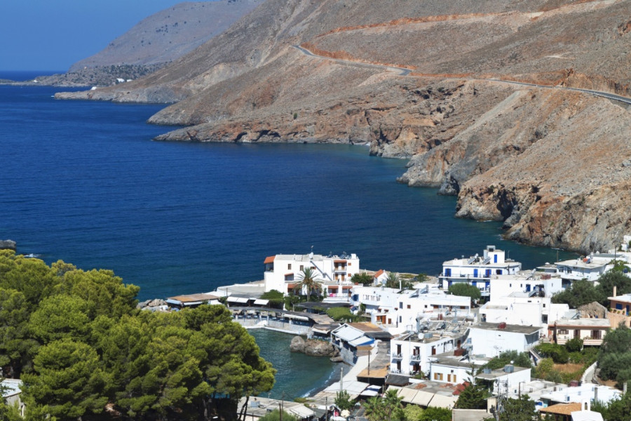
We call Sfakia both the south-eastern area of the Prefecture of Chania and the town of Sfakion, the port on the south coast of the prefecture and the seat of the Municipality of Sfakion, which is 75 km from Chania.
The Municipality of Sfakion is the most sparsely populated in all of Greece with an area of 468 sq.km., population 2484 inhabitants) and includes the villages of Chora Sfakion, Anopoli Agios Ioannis, Agia Roumeli, Asfendou, Loutro, Patsianos, Skalokoti, Istraglou and Fskif.
The whole of Sfakia is characterized by the natural beauty of a wild mountain landscape which is uniquely combined with the sea.
Paleochora
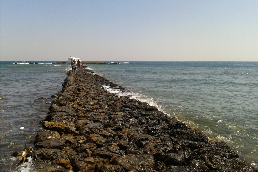
Paleochora was a quiet fishing village that has become a tourist resort. Located in the southwestern part of the prefecture of Chania and is 74 km from the city. A special feature of the region is that it is the southernmost point of our country and the southeastern geographical point of Europe.
Vrises
30 km southeast of Chania, and 2 km from the National Road of Rethymno there are a beautiful village with 850 permanent residents, built in a valley full of trees, ornamental vegetation and running water. At the intersection with the National Road, there is the “Greek Kamara”, a Greco-Roman bridge with characteristics from more recent times, such as Venetian and Ottoman.
Also noteworthy are some churches in Vrises and the surrounding villages.
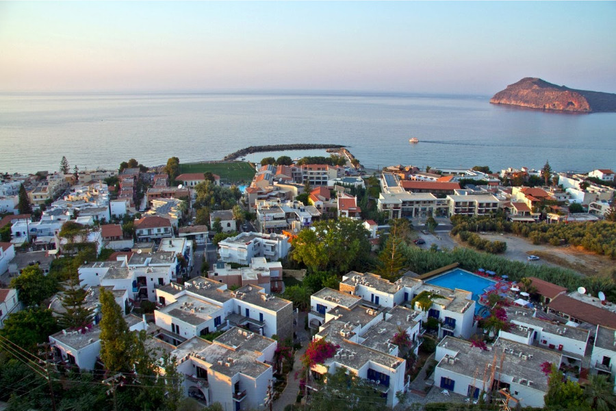
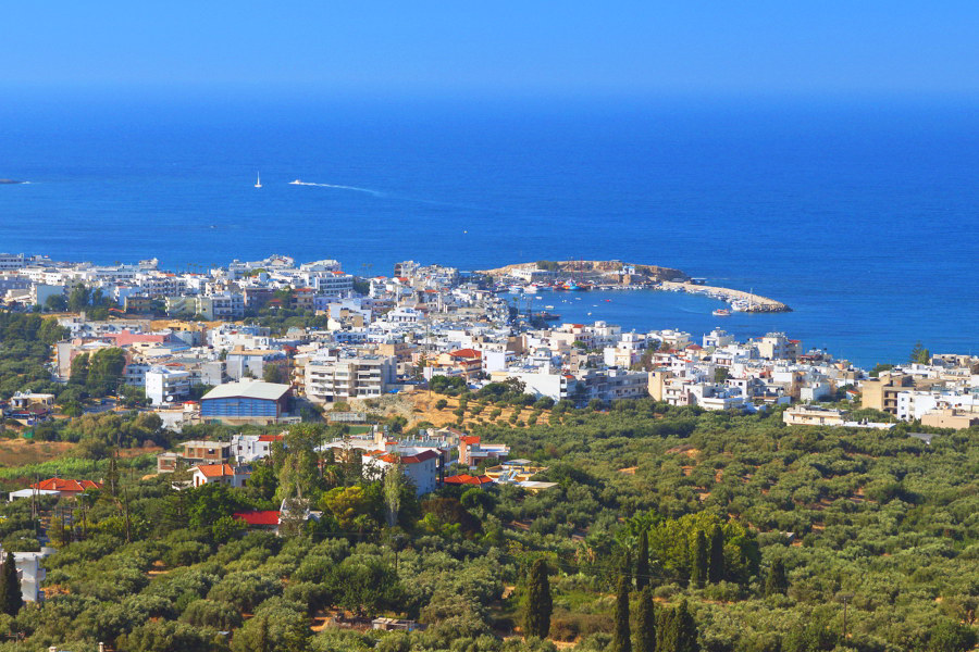
Georgioupoli
A seaside village that has developed into a modern tourist resort. Located 38 km southeast of Chania.
The village is located in an area full of trees and greenery, at the mouth of the river Almyros. At this point there is the small port of the settlement, with houses, small and fishing boats.
RETHYMNO
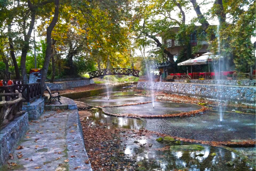
Argyroupoli
Located 27 km from Rethymno on the route of the old national road Rethymnon – Chania.
The village is built on the site of ancient Lappa and rarely combines natural beauty and history.
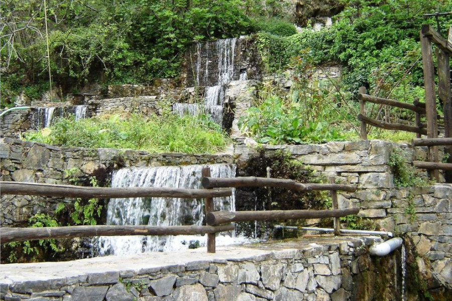
Near Argyroupoli is the location “Piges” with orgiastic vegetation of centuries-old plane trees, small beautiful waterfalls, small lakes, many streams with gargling running waters that move several watermills. Ideal location for coffee, drinks, or even delicious food in an environment that really whets the appetite. In the same place you can see the small church of Agios Ioannis and Agia Dynami that is built under a large rock.
Eleftherna
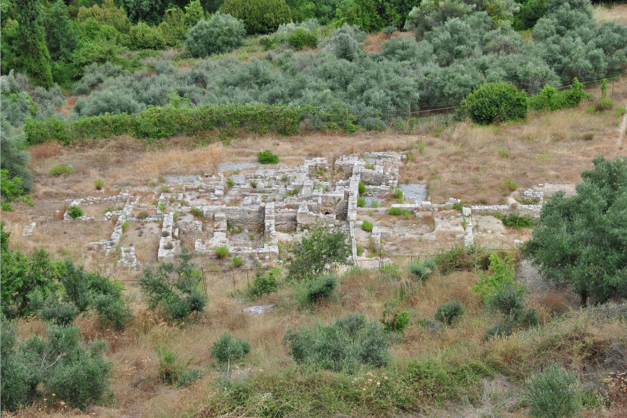
Eleftherna is located in the province of Mylopotamos, 25 km southeast of Rethymnon. Since 1972 it has been characterized as a “landscape of special natural beauty” and a protected archeological site. Opposite the village are the ruins of one of the most important cities of ancient Crete. Ancient Eleftherna flourished after the 8th century BC, when Dorians from mainland Greece arrived here.
Municipality of Arkadi
The Municipality of Arkadi, one of the 11 of the Prefecture of Rethymno, occupies an area of 123,027 acres and according to the 2001 census has a population of over 5,800 inhabitants.
Its headquarters are located in the village of Adele and has been formed by the following Communities: Adele, Hamalevri, Pigi, Mesi, Pangalochori, Kyrianna, Harkia, Amnatos, Erfi, Skouloufia, Eleftherna, Ancient Eleftherna, Prinos. It is bordered on the west by the Municipality of Rethymno, on the east by the Municipality of Geropotamos and on the south by the Municipality of Syvritos.
Margarites
The village of Margarites is 27 km east of Rethymno. It is located near ancient Eleftherna and used to be called “Magarites”.
Probably the name of the village is related to the Byzantine word “magarikon”.
(The Byzantines called “objects” clay objects, clay pitchers, cups, plates, etc. The old potters of the “shop” vessels may have been called “shopkeepers” and over the years acquired the surname Magarites, as is the case with many names. and they were probably the first settlers of the village).
The Margarites have a tradition in pottery (as well as Thrapsano), in fact the inhabitants of the village still make clay pottery, imitations of ancient Minoan pottery.
Plakias
It is a small fishing village on the south coast of Crete, 35 km from Rethymnon.
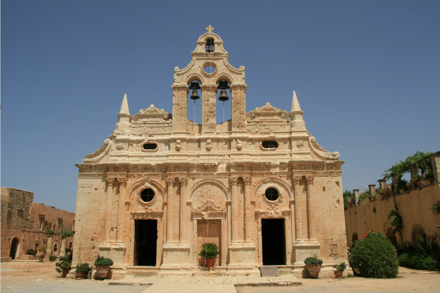
It combines the traditional village atmosphere with a series of bars and taverns along its beach. There are many small sandy beaches in the area, spotless, although the sand has a characteristic gray color. The area is open to Libyan winds, which is why it prefers wind turbines (windsurfing). One can take advantage and visit the monastery of Preveli and the nearby Venetian village of Spili.
Spili
Spili is located southwest of Rethymnon, at 30km and took its name from a small cave in Peristere. Before the village, the visitor encounters perhaps the most impressive Minoan cemetery with 300 carved tombs, most of which remain intact.
Spili is the capital of the province, a transport hub for southern Crete and is an ideal place for holidays, as it is convenient to use it as a base on the south coast of Rethymnon.
Melidoni
The village of Melidoni is located 28 km east of Rethymno near the national road to Heraklion and the village of Perama. Route: Rethymno – Panormo – Perama – Melidoni. Melidoni is famous for its cave, which has archeological and historical value.
HERAKLION
Archanes
Archanes is very close to Heraklion, as the distance between them is only 15 km and they are about 10 km. from the archeological site of Knossos.
The town of Archanes, with a population of 3860 inhabitants, is the administrative seat of the Municipality of Archanes and is built in a relatively small, closed, Mediterranean valley at 380m. altitude. West of the settlement rises the landmark of Archanes, the anthropomorphic Mount Yukhta, which overshadows it and ancient traditions have associated it with myths and legends about gods and heroes.
Chersonisos
The Port of Hersonissos is a coastal settlement and former community of the province of Pediados in the prefecture of Heraklion, with 2,981 inhabitants in 2001. Today it is a town, Municipal District and seat of the Municipality of Hersonissos. Its location is at 26.1 km of the main road to Agios Nikolaos, at the site of the ancient city of the same name. In the Port of Hersonissos, which is developed for tourism, there are KEP, Primary school, 2 Kindergartens, High School and Lyceum, post office, OTE, as well as a regional doctor’s office. The main occupations are tourism, olive growing, viticulture and early vegetable growing. In the settlement we find the churches of the Annunciation of the Virgin Mary and the old one of Agia Paraskevi in Kastri.
Matala
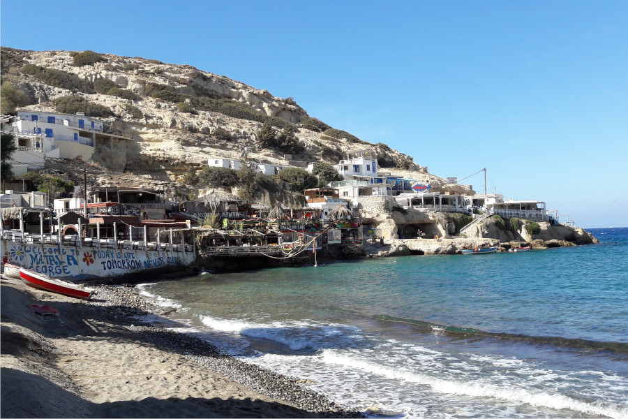
Matala is a small seaside village and a famous beach in southern Crete in the prefecture of Heraklion. Their location is on the west coast of Pyrgiotissi province. The beach of Matala has been inhabited since ancient times, and the then inhabitants carved a set of caves in the soft rock of the mountain. The caves remained empty for thousands of years until some wandering hippies discovered them and inhabited them for some time. Several others followed them, such as Bob Dylan, Janis Joplin and Kat Stevens. The village used to be a fishing village and today it lives mainly from tourism. It belongs to the Municipal Department of Pitsidia of the Municipality of Tympaki. Its distance from Heraklion is 70.6 km.
LASSITHI
Agios Stefanos
Mountain Community District between Pefkos and Stavrochori. Its old name was Graas and it refers to the Venetian census of 1583 with 305 inhabitants, it seems to be a family Venetian name. It is 39 km from Sitia and 31 km from Ierapetra.
Makri Yialos
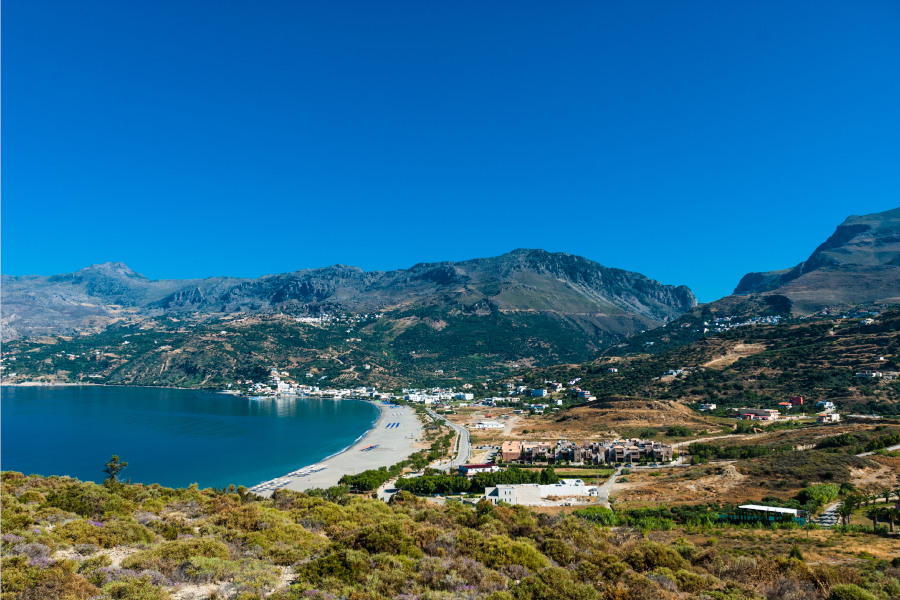
It is located 30 km east of Ierapetra and 33 south of Sitia on the southern road axis Sitia-Ierapetra. It is a well-known tourist resort in the Libyan Sea, near the village of Analipsi. Makry Gialos was a small fishing village, but now it has become a well-known tourist resort due to its warm local hospitality. The village maintains its traditional character and is ideal for those looking for peace and picturesqueness on their vacation.
The name Makry Gialos comes from the big sandy beach that exists there.
The crystal clear and shallow waters of which are ideal for children but also for adults.
Elounda

It is located 11 km North of Agios Nikolaos, 70-77 km East of Heraklion International Airport (New or Old National Road) and 80 km West of Sitia Airport. It has 1650 permanent residents.
Elounda is a popular destination for a large number of tourists, Greeks and foreigners, where the visitor has access to a sufficient number of hotel units of all categories up to rooms for rent. Taverns, restaurants, bars and other centers of all kinds fully provide food, drink and entertainment for visitors.
Sitia
Ancient city of Eastern Crete, home of the poet of “Erotokritos” Vicentzos Kornaros, Sitia was inhabited and flourished in the Minoan era and in all historical periods of Crete from the Classical times to the era of the Ottoman conquest.
It is located 64 km east of Agios Nikolaos, 129 km east of Heraklion and 61 km northeast of Ierapetra. It is inhabited by almost 10,000 permanent residents.